LAND SURVEYING
|
SEC’s surveying staff has completed thousands of surveys, from the smallest of residential lot surveys to multi-section Public Land Survey System retracements. Our work has met the highest technical and professional standards. Our licensed registrants have prepared numerous legal documents including: land descriptions, elevation certificates, easement descriptions, subdivision plats, results of survey maps and corner monumentation certificates for recordation in the public record.
|
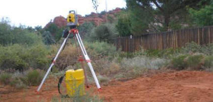
SEC utilizes Global Positioning System (GPS) equipment, fully automated total stations, robotics, Geographic Information Systems (GIS) mapping and CAD drafting software. Field data is collected electronically and transferred into AutoCAD, Microstation or ArcGIS as necessary to meet specific project needs. Data analysis, processing and map preparation is accomplished by our professionals, technicians and drafting staff.
SEC has been actively working in Cottonwood and the Verde Valley area since 1974 and has compiled a vast archive of surveying, engineering and water rights files. We hold ownership of the surveying files from Joe Jones & Associates, who was the premier surveyor in the Verde Valley from the 1970’s through the 90’s. This holding contains over 3000 surveying records as well as the original layouts for the water and wastewater lines in Cottonwood and the overall city drainage study. Our archives of historical surveys include the records of other surveyors such as George Blount, Patrick Naville, Harold Hallett, Leroy Gaberel and Mingus & Associates, dating back to the 1950s and also containing over 3000 records.
SEC has been actively working in Cottonwood and the Verde Valley area since 1974 and has compiled a vast archive of surveying, engineering and water rights files. We hold ownership of the surveying files from Joe Jones & Associates, who was the premier surveyor in the Verde Valley from the 1970’s through the 90’s. This holding contains over 3000 surveying records as well as the original layouts for the water and wastewater lines in Cottonwood and the overall city drainage study. Our archives of historical surveys include the records of other surveyors such as George Blount, Patrick Naville, Harold Hallett, Leroy Gaberel and Mingus & Associates, dating back to the 1950s and also containing over 3000 records.
Learn More About Our Surveying Services Below
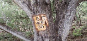
Public Land Survey: SEC’s surveyors can perform any Public Land Survey System (PLSS) survey including but not limited to: Independent Resurvey establishment of new lines without reference to the corners of the original survey; a Dependent Resurvey retracement and reestablishment of the lines of the original survey in their true and original positions according to the best available evidence; Retracement Surveys to ascertain the direction and length of lines and to identify monuments and other marks of an established prior survey; and sectional subdivision to subdivide the originally located 640 acre sections into what are called aliquot parts of quarters, sixteenths etc. based on the original marks and monuments.
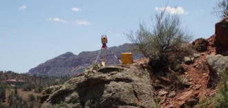
Cadastral Survey: Property Boundary Surveys involve the establishment or re-establishment of the property lines be it a single small residential lot or thousands of acres of forest land. These types of surveys involve the establishment of corners and monuments and, in some cases, the marking of each line at established intervals depending upon State and Federal requirements or property owner’s needs. Land surveying is both an art and a science. This is as true with cadastral surveys as it is for other survey types. How are cadastral surveys conducted? This type of land survey involves first determining the historic boundaries of the land, through deeds and other descriptions. Then, the surveyor measures the land itself in accordance with the legal description of the property. Boundaries are marked on the land itself in any number of ways. Finally, any discrepancies between the historic boundaries of the land the boundaries according to the legal description are investigated. Cadastral surveys are generally used for public-use land, though cadastral survey methods have much in common with residential land surveying and other types of land surveys conducted on private or commercial land. Typically, the term Cadastral has come to mean surveys of public lands of the United States. Today, most of the United States, particularly the west, has undergone a cadastral survey at some point thanks to the Public Land Survey System, which formed the basis for original homesteading of the land.
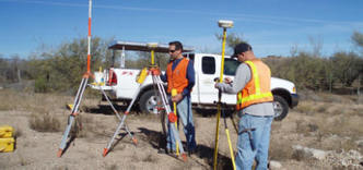
Land Development Survey: The largest portion of SEC’s surveying work is completed in land development, including minor land division survey services. Our services are utilized for applications, recording, subdivision plats including phases of the plat during the approval process, and ALTA/ACSM surveys which are often required in order to obtain financing title insurance and for due diligence in site selection.
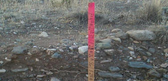
Construction Survey: SEC’s surveying staff has completed thousands of surveys, from the smallest of residential lot surveys to multi-section Public Land Survey System retracements. Our work has met the highest technical and professional standards. Our licensed registrants have prepared numerous legal documents including: land descriptions, elevation certificates, easement descriptions, subdivision plats, results of survey maps and corner monumentation certificates for recordation in the public record. SEC utilizes state of the art technology in our Global Positioning System (GPS) equipment, fully automated total stations, robotics, Geographic Information Systems (GIS) mapping capabilities and CAD drafting. Field data is collected electronically and transferred into AutoCAD or ArcGIS as necessary to meet specific project needs. Data analysis, processing and map preparation is accomplished by our professionals, technicians.
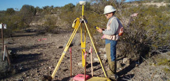
Hydrological Survey: SEC specializes in hydrologic surveys which include flood certification surveys that ascertain the relationship of land and buildings to the elevation of flood waters as required for Federal Emergency Management Agency (FEMA). These surveys are often used for building permits, design modifications and by the issuers of flood insurance. Flood hazard mapping surveys are a component in the calculation of the potential dangers of flood waters to structures in floodways and for the revision of Flood Hazard maps. The information gathered is also used by local flood control authorities and by FEMA to generate and update Flood Insurance Rate Maps (FIRMs). Watershed surveys performed by SEC involve the measurements of stream channels and channel restrictions for designing structures such as culverts, bridges and infrastructure.
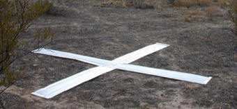
Photogrammetric Survey: SEC completes aerial panel control placement that establishes and marks the controlling monuments from which horizontal and vertical parameters of the resultant aerial map will be established. SEC also completes topographic mapping surveys, through various methods which accurately depict the three dimensional shape and form of land surfaces.
